-
TECHNOLOGICAL CONSULTING FOR VALIDATION, VERIFICATION AND MONITORING OF CO2 CAPTURE PROJECTS
MAPPING, FIELD SAMPLING, CARBON MODELING, ADDITIONALITY AND MONITORINGGIS, REMOTE SENSING, SATELLITE, DRONES, PROGRAMMING AND ARTIFICIAL INTELLIGENCE (AI)
CO2 capture projects
Mapsens® Carbon is the perfect tech partner for the development, validation and monitoring of CO2 capture projects. We combine the use of drones, AI, self-developed apps and the best professional team to give a comprehensive, efficient service. Mapsens® belongs to the TYC GIS Group, a leading multinational company in the geomatics sector and in the use of drones in the agricultural and forestry sectors.
Since 2013 we apply GIS and remote sensing in all its variants in order to give practical and high quality solutions to our customers. Contact us
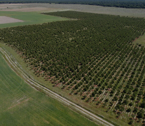
Project mapping and cartography
We provide all the necessary tools for the project surface digitisation whether, due to the characteristics of the project, field work is necessary or desk-based work is sufficient.
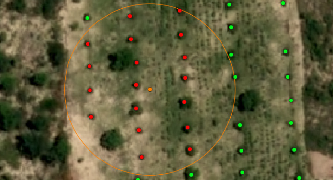
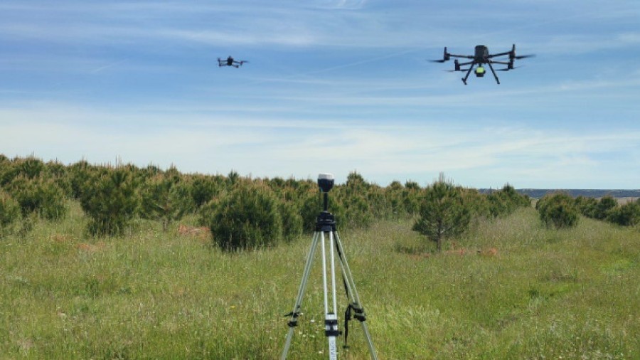
Field work
Since all the standard methodologies for CO2 capture projects proposed by the main certifying bodies require field sampling by traditional methods, TYC GIS offers the full implementation of this process.
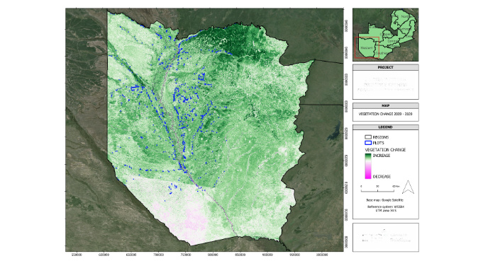
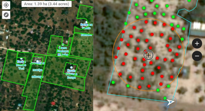
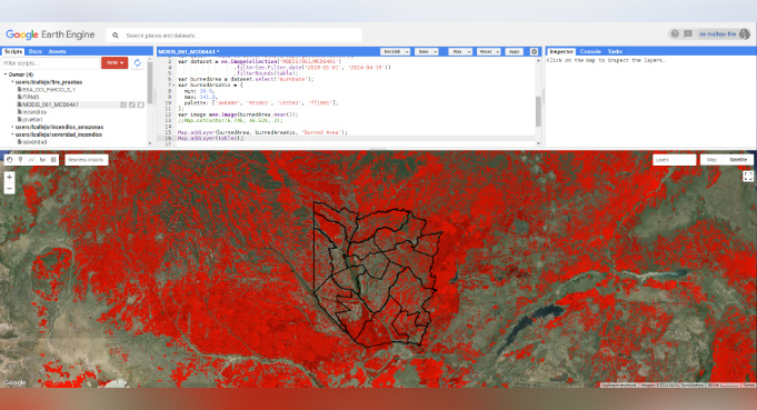
Additionality, baseline and risks
Baseline calculations: all the standard methodologies for CO2 capture projects proposed by the main certifying bodies require the establishment of a CO2 exchange baseline.
Mapping and reports
All the cartographic products are generated, both for internal use of the project promoter and for inclusion in the deliveries required by the certifying bodies for project validation and verification of the generated carbon credits.
Our clients