
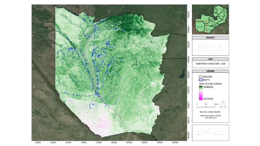
Baseline calculation
All the standard methodologies for CO2 capture projects proposed by the main certifying bodies require the establishment of a CO2 exchange baseline. The goal is to determine the difference in CO2 capture between the project surface area and the same surface area if the project were not carried out, in order to determine the additionality of the project and, after applying corrections, the carbon credits to be awarded. At TYC GIS we offer the calculation services of the project baseline in two possible ways (depending on the standard methodology used):
Dynamic method
One of the world’s leading certifying bodies of CO2 capture projects, Verra, published in September 2023 what was the first standard methodology for baseline calculations on forestry projects using dynamic methods, as part of their VCS “Verified Carbon Standard”. This methodology, coded “VM0047” and named “Afforestation, reforestation and revegetation”, establishes the “Performance Benchmark” method which, based in the calculation of a remotely sense index related to the carbon stored in an area (known as “Stocking Index”), determines both the baseline and the additionality of the project for each verification period. At TYC GIS, given our extensive experience on remote sensing products, we offer the calculation service of the baseline and the demonstration of additionality through dynamic methods, both based on the standard published by Verra and based on those expected to be published by other certifying bodies in the future.
Static method
While the leading certifying bodies publish their standard for baseline calculations based on dynamic methods, other standards that use static methods are still in use. TYC GIS also offers the service of baseline calculations for forestry projects through static methods.
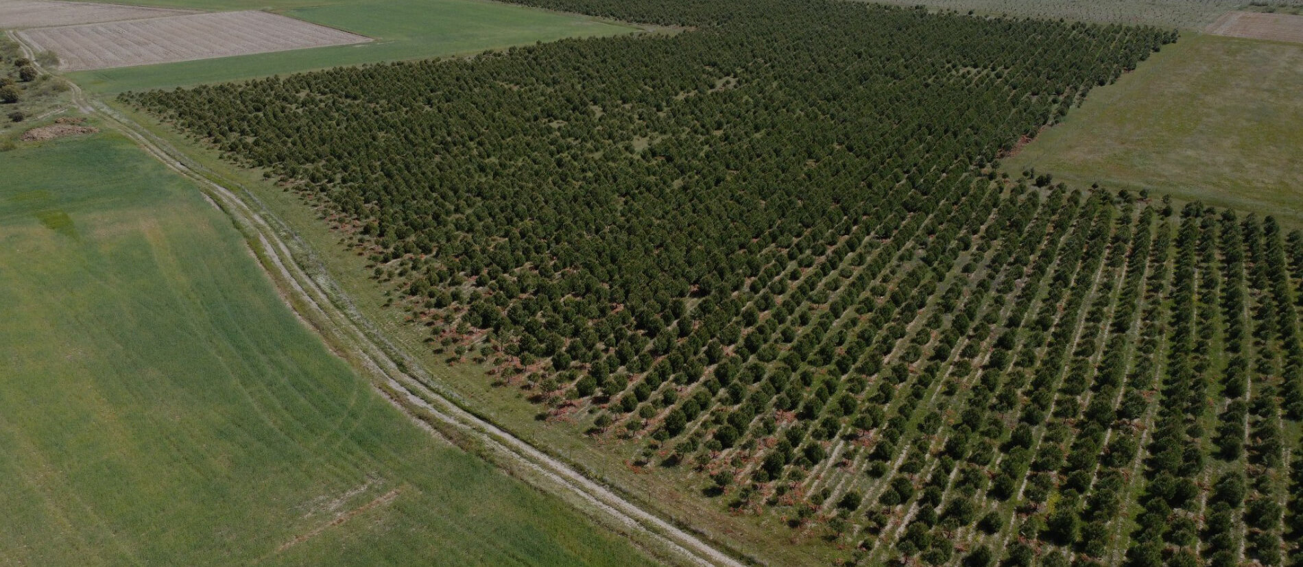
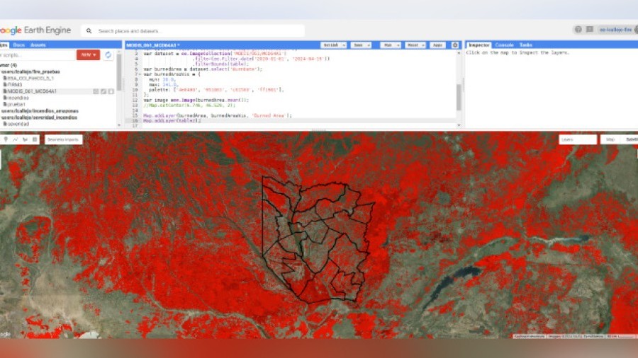
Calculations of burnt surface area and severity
Given our extensive experience on both remote sensing and GIS, we offer the calculation service of the (possible) burnt areas that may affect the project surface area and the severity of the wildfires in each zone. This calculation is required by some standard forest carbon project certification methodologies in order to quantify the final CO2 balance of the project.
Calculations of absorption and CO2 balance, allometric and growth modeling
Allometric and growth modeling: if no allometric models exists that are sufficiently adequate for the tree species and geographical location of the project, we offer the possibility to develop our own models from data taken in the field, including the cutting and weighting of a small representative sample of the planted trees in order to develop the equations and make them scientifically valid. We also offer the possibility of modeling the growth of the trees by taking data in the field in order to estimate the CO2 that the project will absorb during the accreditation period.
Ex-ante estimation
Carbon forestry projects require an estimation of the CO2 that will be absorbed as a result of the project (and thus the carbon credits that will be awarded) throughout the accreditation period. Apart from being a requirement of the standard methodologies, Ex-ante estimation is a very useful tool for the entity benefiting from the carbon credits to estimate the performance and the return that the project will generate. TYC GIS offers the full service of calculations and preparation of the final ex-ante estimation documents.
Absorption and CO2 balance calculations
Based on the gathered data, manually on the field or with drone flights (depending on the methodology used), we offer the service of calculating the absorbed CO2 by the project and its final CO2 balance during the verification period, in order to apply for the corresponding carbon credits. This phase is also known as ex-post calculation.