Field work
Since all the standard methodologies for CO2 capture projects proposed by the main certifying bodies require field sampling by traditional methods, TYC GIS offers the full implementation of this process, including:
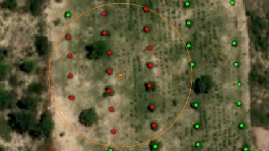
Sampling design
According to the project characteristics and to the standard methodology applied for the CO2 capture certification, we choose the sampling type to perform (systemic, random,..), as well as its intensity, possible stratification, variables to be measured during fieldwork and the location, size, form and number of the sampling plots to be established.
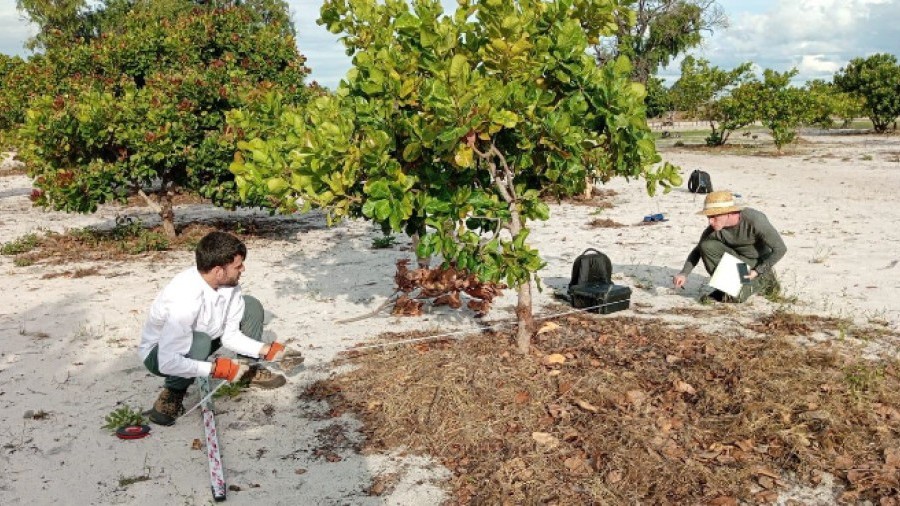
Manual sampling
We take care of the data sampling itself. This is, the establishment of the sampling plots and the measure of the defined variables during the design phase according to the standard quality criteria. TYC GIS has all the necessary equipment and tools to carry out this work.
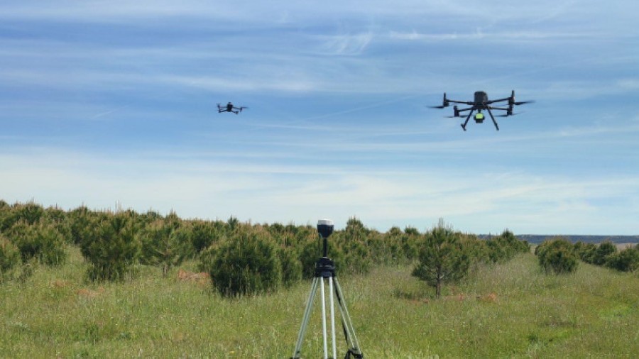
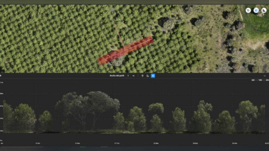
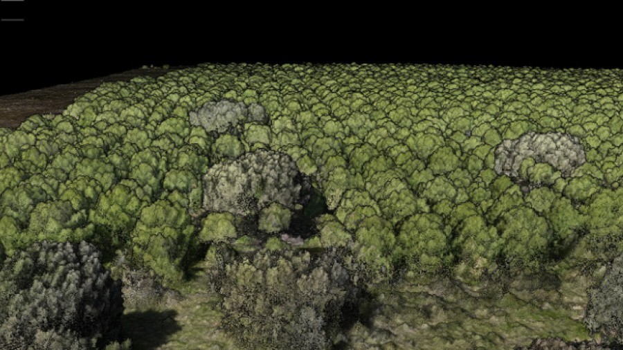
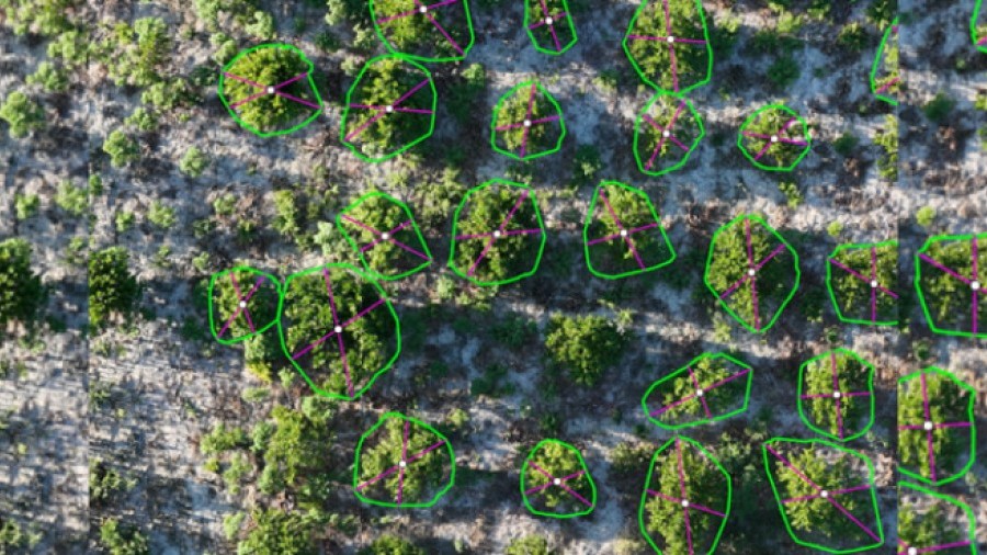
Drone flights
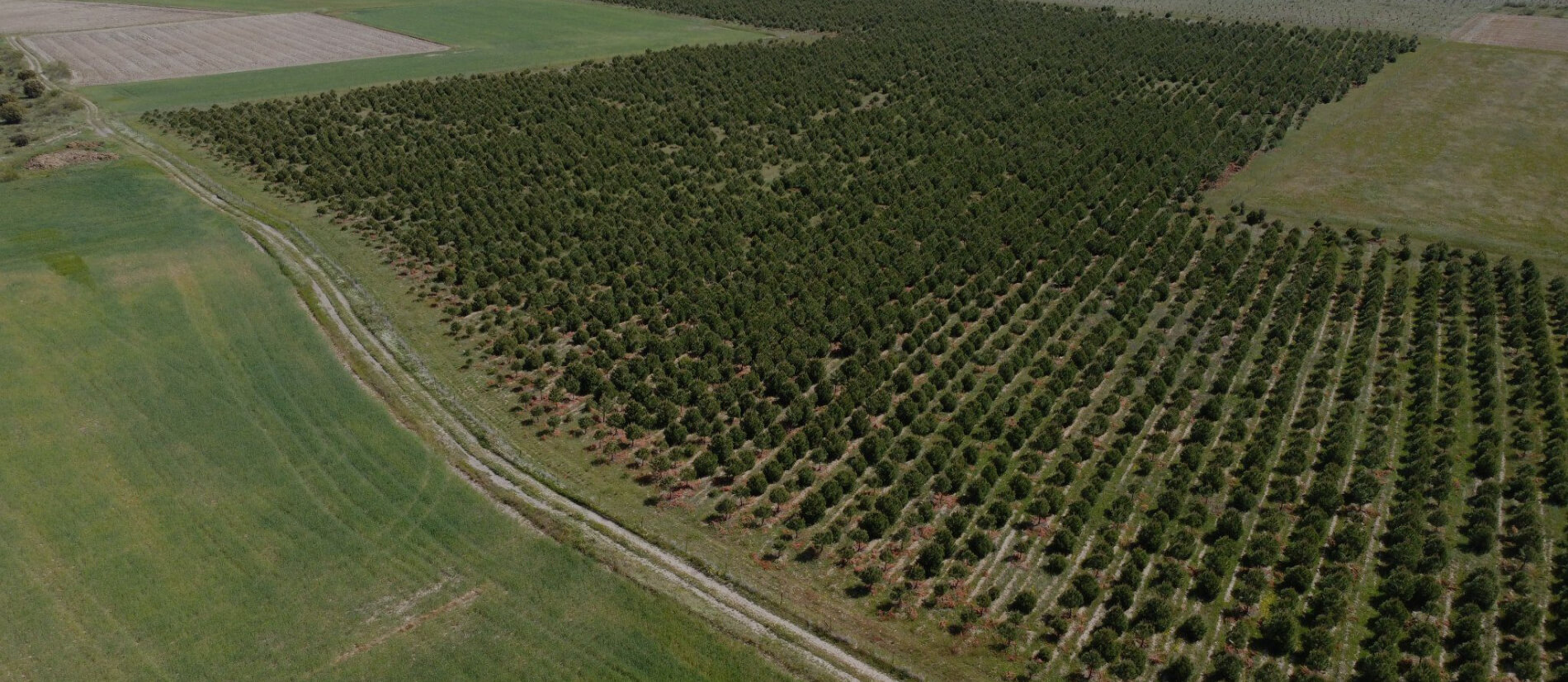
Besides the manual data sampling required by the methodologies, we offer the drone data sampling, equipped with RGB, multispectral and LiDAR sensors. These data can be used for monitoring the state of the plots in terms of vegetation health of the planted trees (or other present plants) or their water stress, as well as measuring morphological variables of the trees (heights, diameters, crowns, etc.) than can be used in a possible modeling of the trees in the calculation of the CO2 absorbed. The main advantage of drone data sampling is the possibility of mass measurements over a much higher percentage of the surface of the project compared to traditional sampling, leading to higher accuracy (and therefore lower uncertainty) on the estimated absorbed CO2.